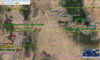
Jurassic Navajo sandstones (in Mesazoic Southern Utah) are used to illustrate Earth Dynamics on a meter to a Regional scale, where the Virgin anticline has triangles, Quadrangles, and broken Polygons:
Snow canyon, near St. George, Utah has Arcs of polygons- the next larger dynamic:
Regionally, the Virgin anticline exhibits one side of a Hexagon- shown as superimposed colored lines; these follow inflections in the topography:
Above photos are used to show that the Geo Culture plates are broken into many smaller polygons- such that their use yields the details of Earth Dynamics. Surmised is that Earth, or Land Tides, are propelling these by gravitational attraction from the Moon, our Sun, Planets near the Ecliptic plane, with a ratio of Moon/Sun of 2.16. Moon Diagram below is the proponent of the Energy, but it requires a trigger of an added 2D alignment of a planet to create earthquake.usgs.gov shown below:
Spirals, above, are created with uplift, as with the Zion NP with its Arc Divider.
Below is a canyon "S" or Rise in the local uplift:
Fractures are sides of polygons- which vary in separation due to the various solar system bodies at work- through time:
Rock sample below has been subjected to Rotation, shear, and crushing; note the repeated dark shearing in a figure 8 configuration- with a new slice across the midsection:
Hand sample which has been rotated within Larger rotations indicates reversal of movement in a 20 cm outcrop (then broken off for collection):
Rocks above were measured for details;
Polygon count was made at a scarp near Hurricane, Utah:
Value of all this is to show that Polygons are local as well as regional to Continental, and that these replace the breaks in the plate theory- where there is no geological explanation:
Bowers Ridge, above, is a set of sufficient polygons such as to appear circular or Arcuate; this less than 40 m.y. half of a Figure 8 is measured for the focus distance shown.
Eighteen-sided Emperor seamount chain is shown to have sides of a Pacific Polygon:
Australia Continent is a set of polygons surrounding a 2500 km craton:
Green coast lines are 1777.777 km in length- where 16,000/1777.777= 9.
Next is to show that most Vibration occurs along the Earth's surface (sideways): Transform faults, Storms, flows of lava, and earthquake.usgs.gov move sideways in the Crust, as below:
Ledgewood, Whidbey Island had a slump onto the Puget Sound beach- which is mostly to the left:
All this is to introduce Vibrations of the Crust- mostly Lateral in units of millihertz (.001 cycles/second) of 2.7 to 4.5, averaging 3.6/second. Invertng, this is 1,000 seconds/cycle x 3.6/16.67 minutes, or a cycle each .278 hours. Frequency is similar to Lightning Waves, and audible Thunder from Storms- somewhere on the Earth's surface.- 16-17 minutes apart:
There are many types of waves on Earth's Crust; below is a Jurassic sandstone canyon- called "the Wave"; angled layers are called interdunal episodes by geologists, and I have found that they slide along the planes via Earth Tides:
Whidbey Island was subjected to waves of sliding ice and melting water; below is the Coupeville (town) outwash plain from the last ice age:
Erosion follows fractures- which are seen in scarps or cliff faces as successive channels:
Whidbey Island above had Mt Baker closer to the north than Mt Rainer, and I will bring up photos I made of it, to analyze the relation of the two- which are most-feared in Seattle:
Mt Baker location and view:
Mt Baker is 272 km to the outskirts of Mt Rainer- making an ET with an offshore ellitical feature in shallow terraces. It appears that earthquake.usgs.gov created by jerks at R create Heat at Mt Baker. Warm spot in May/1994 on SE flanks (25 years ago) was visible among thick snow. Calibration of specific movemets has found that 1/10th km (100 meters=100,000 mm) takes 1 k.y. (1000 years) approximately. Result is 100 mm/year- where the Hi-emperor chain has 86.
Above photo of the snowy peak was from my dwelling on Whidbey Island.
Above is from the south.
We must distinguish Waves as Electrical (lightning, Earth hum, magnetic pole changes, or CME from the Sun), Gravitational (continuous), our Moon rocking the earth (Libration), Radioactivity (continuous), Space interference (supernova, Sun tilt change, or Strikes), and artificial disturbances- such as atomic explosions, mass movement at mines, and water diversion.
Wave cycle at Sand Mountain, Utah has linear parallel patterns:
Above shows the measured Google Earth separations.
San Andreas fault map shows a system of Lateral faults:
San Francisco Bay with ages shown by separated linears:
Linear Tramsforms from Cape Mendocino starting 16 m.y. ago at the coast (calculated at 8 mm/year Earth Tides):
Line Islands are a set of disconnected rises- previously volcanodiscovery.com
Linear 2400 km Atlas Mountains, Africa have grown to the NW as the Continent developed a bulge, or Orb to the west:
Speculative is the relative age of the Andes, Atlas, Owen Stanley, and the Sierras- proportional to their different lengths:
Sierras 800 km are inland- separated by the CA Valley, but most Ranges are nearer the coast:
Olympic Mts are 800 km from the Mendocino Cape (7.2 degrees of latitude change) and are rootless- having moved NE since the Eocene; note drainage moving to SW, and the feature exhibits Reverse Tides (going against the normal 20 mm/year west movement):
Mt Olympus- in the center with snow- is not a volcano- although it arrived with the Cascades after the Columbia flood basalts of 16 m.y. age.
Earth Wobble cycle, as shown in the Literature, relates to the Sun which is shown below:
Note the years above- taken to complete one spiral; it is near 10 years- compared to 11 years for the average Sunspot cycle. 12.5 is the maximum via literature.
Earth circumference/4 at midlatitudes is 10,000 km; this quarter separates many catastrophes: the South America orb near Lake Titicaca arcs back to the Equator via island, seamounts, and uplifts; not a total displacement, but one uplift shoving the adjacent one- as with compression of nearby masses:
Earth in curved spacetime, as Einstein speculated, has a 10,000 km radius- shown in green:
Above is speculation, but this 10,000 km separates many trenches, rockfalls, earthquake.usgs.gov and volcanodiscovery.com
Above detail for the arc of uplifts offshore South America.
Colorado Plateau- Cp- is somewhat elliptical, above.
Above is a duplicated diversion of the Colorado Plateau's Colorado River- which yields clues about the cyclical repetition of its Lateral movements through Time.
Above Cp cycle in years may be csalculated with Distance/ Rate of 10-100 mm/year.
Chatter (d{jerk}/dt) is shown for large scale Colorado River:
How does the Colorado plateau Cp fit in the 40 m.y. anomaly?
Above shows that the ellipse has a perimeter of 2400 km; circular diameter 2400/pi= 763.9 km, and now to find the start- where I have worked at the Sangre de Cristo Mountains at Eagle Nest, NM to view Cretaceous Poison Canyon sandstone:
Above (in time also) is the Poison Canyon is Teriary Tuffaceus siltstone- which is influenced by vulcanism; Angel Fire ski moutain has volcanic remains today, and I have seen the Crystal Tuff there.
Above photo at base has the turnoff to Angel Fire ski resort, with it ski mountain at SE; the Tuff may be the start of 40 m.y. uplift, but the Rio Grande rift at Taos, NM is expanding today as seen at Llano Quemado (burnt plain in Espanol):
Above is a photo of a rift- not the correct Rio Grande one.
Literature diagrams above show Normal faulting.
Taylor Creek fold is to young for this analysis, but yields a photo from my files- to distinguish one from the Tertiary Tuffs we seek:
Rocky Mt to Cimmaron, NM; included is the Rio Grand, in the Llano Quemado volcanic plain:
Rocky Mountain arcuate trend, which includes Cp:
Abve shows that Cp is closer to an ellipse, and is a clue to its expansion north since inception 40-41 m.y. ago.
Cuba calculations may include the 40 m.y. age:
Costa Rica, Central America, has a 40 m.y. inflection- shown from Literature:
Kinmei seamount in the Emperor chain is near 40 m.y.:
40 m.y. Age occurs in the calculations from arcs many times, and the error is unknown; I anticipate that it was due to a Strike in Siberia, which bounced near Hawaii- throwing the chain off its path 45 degrees. This might affect the entire Northern Hemisphere, below:
LaGrange Equilateral Triangle ET may be used to relate recent earthquake.usgs.gov with future volcanodiscovery.com and the case of offshore Cape Blanco, Oregon, Mendocino, California 40.439N has an ET at a transform to be confirmed by the University for Heat and location. Side distance is 335.5 km, and the Crater Lake 7700 years age on the corner of a 60,60,60 degrees corner yields 22.95 mm/year (km/m.y. identical) Earth Tides west movement.
Cape Blanco critical coordinates:
Calculation of Rates from Google Earth distance measurements:


nice blog!
ReplyDeleteComments have been mostly irrelevant, and see other links: quadransphere.blogspot.com
ReplyDeletenValuable Blog!
ReplyDelete